
Visual Reference for Bible Study
Biblical Atlas & Charts
Maps, kingdom timelines, and prophetic charts to set the Scriptures in their place and their times. A growing collection — every label links straight into the Bible Translation Engine, so you can read the passage behind the picture.
Print & Share
Download the Charts
Every chart on this page is available as a high-resolution poster — a 2400 px PNG for printing or sharing, and a vector SVG that scales to any size without blurring. Free for teaching, study, and ministry use.
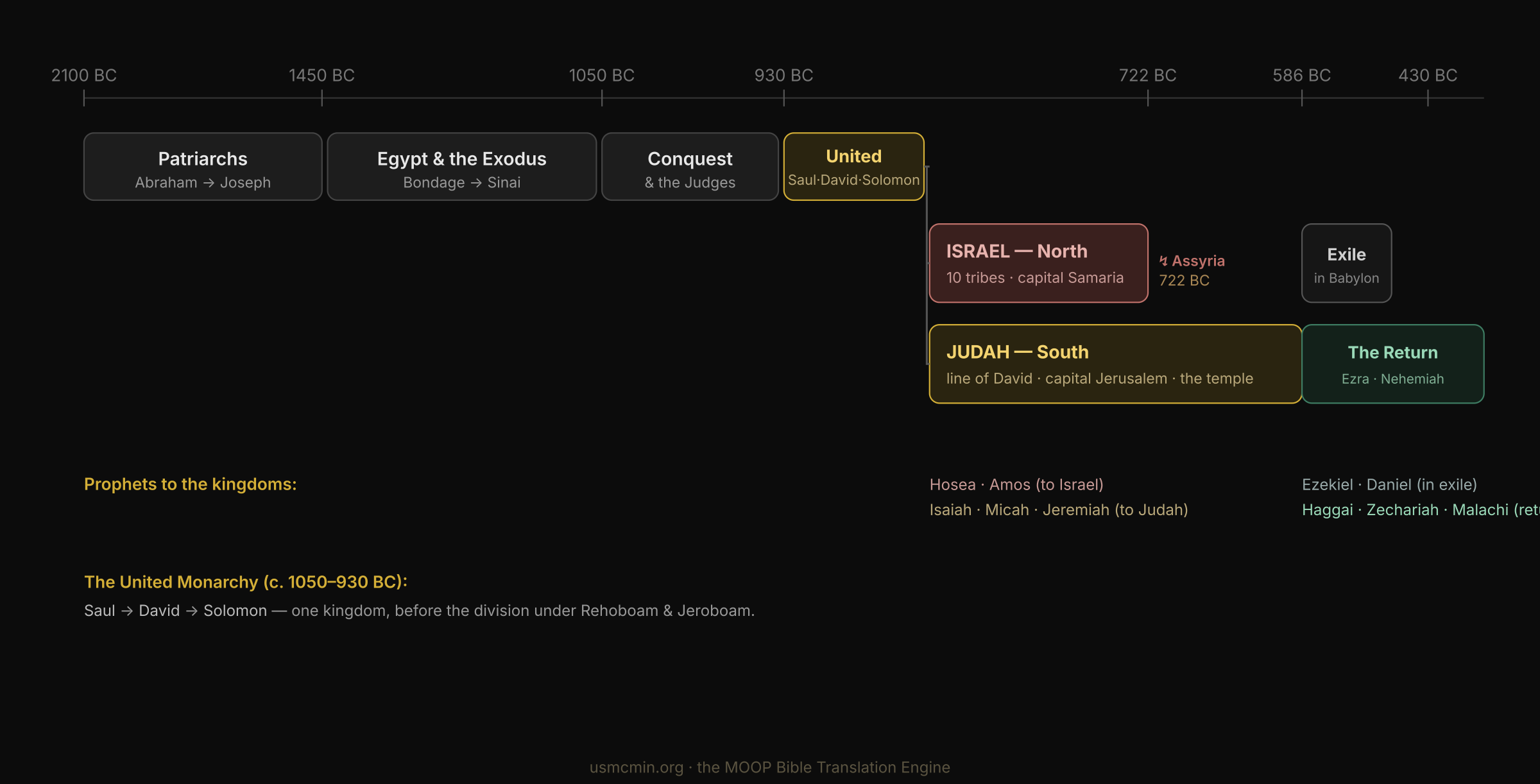
The Kingdoms of Israel & JudahPNGSVG
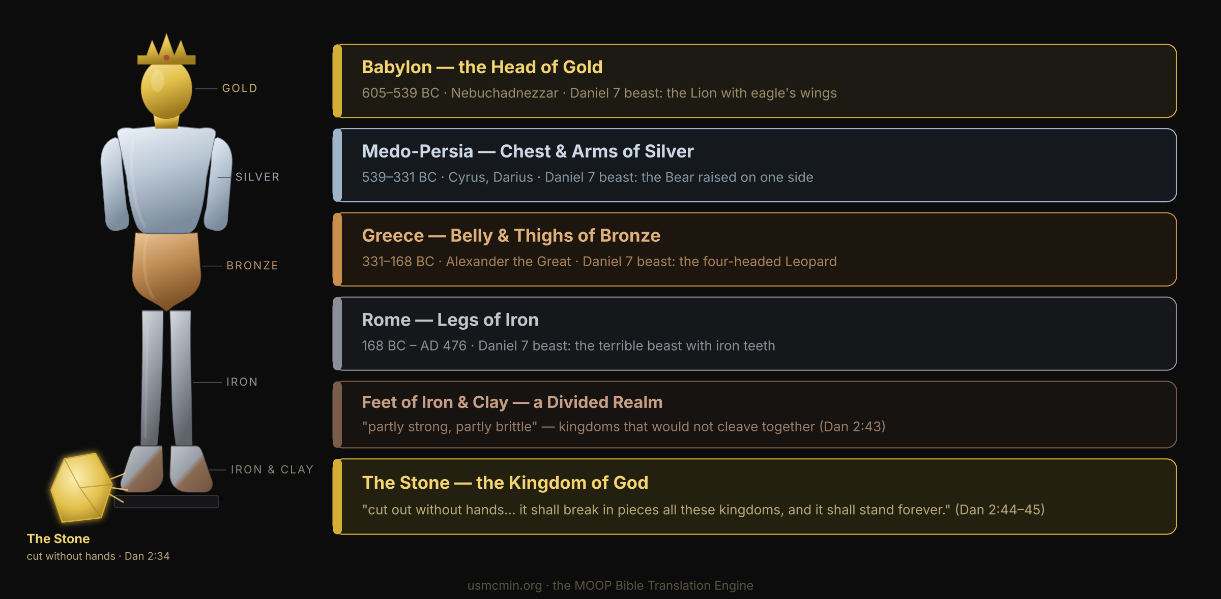
Daniel's Four KingdomsPNGSVG
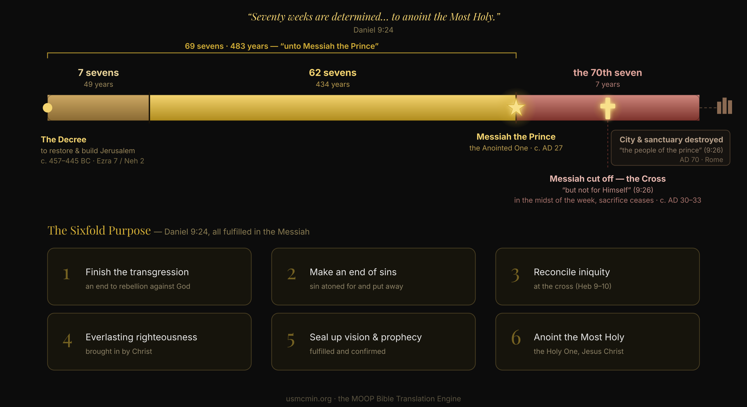
Daniel's Seventy WeeksPNGSVG
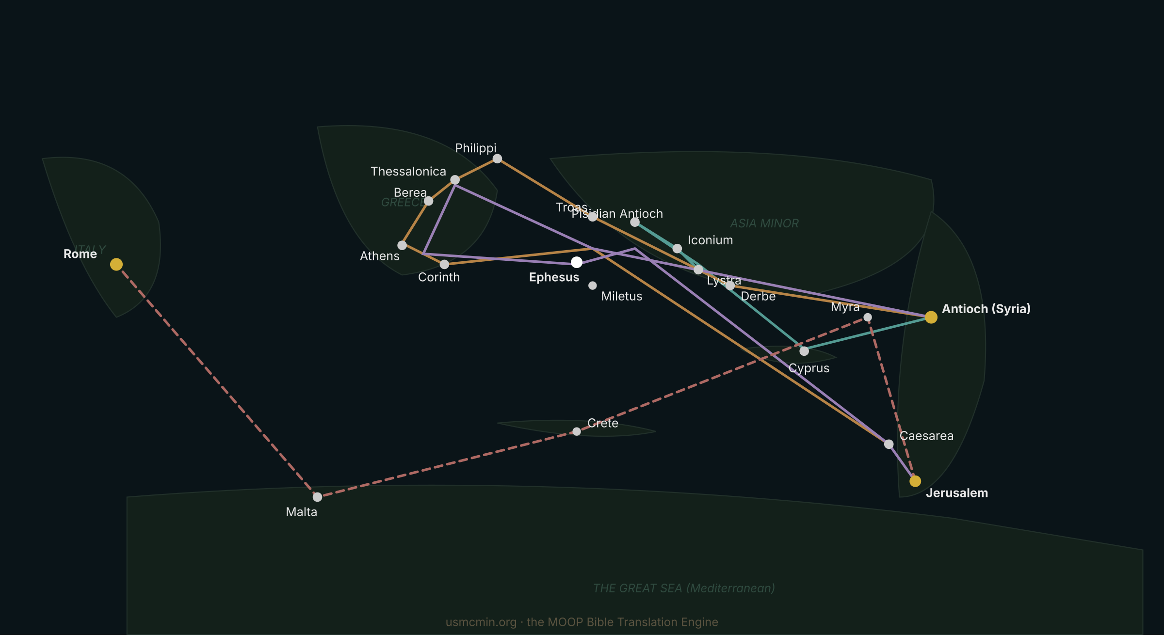
Paul's Missionary JourneysPNGSVG
Posters are generated from the live charts with scripts/export_atlas_posters.py, so they stay in sync as the collection grows.